

Right place, right time, to see glacier calving
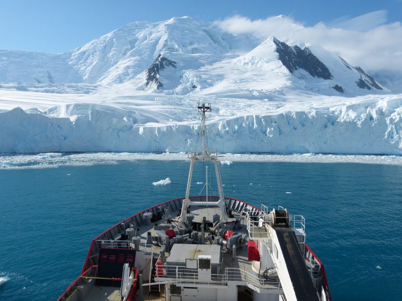
The British Antarctic Survey (BAS) posted this video on YouTube on November 24, 2022. It’s a clip taken in 2020 during an expedition of their research vessel RRS James Clark Ross. The researchers were taking measurements in the ocean off the Antarctic Peninsula, when the front of the William Glacier disintegrated before their eyes. This dramatic video is the result. And, as the scientists gazed toward the calving glacier – and the churning ocean surface – their instruments were recording vigorous underwater tsunami waves, some as tall as a house! That underwater churning led to some useful science. The BAS wrote:
Scientists on a research vessel in Antarctica watched the front of a glacier disintegrate and their measurements ‘went off the scale’.
The William Glacier typically has one or two large calving events per year, they said. And the team estimated this 2020 calving event broke off around 78,000 square meters of ice – around the area of 10 football pitches – with the front of the glacier towering 40 meters [about 130 feet] above sea level.
In the months after the event, the scientists analyzed their results. The open-access, peer-reviewed journal Science Advances published their work on November 23, 2022.
The lead author of the new paper – Michael Meredith of the BAS – commented:
This was remarkable to see, and we were lucky to be in the right place at the right time.
Here’s what makes a tsunami
Scientists call the underwater churning caused by calving glaciers “internal tsunamis.”
Wind and tides create the sorts of ocean waves we see crashing up on a beach. But tsunamis are different, caused by geophysical events where water is suddenly shifted. So, an earthquake, or a landslide, can cause a tsunami. These scientists said:
Until now, no one had noticed that they are happening around Antarctica, probably all the time because of the thousands of calving glaciers there. Other places with glaciers are also likely to be affected, including Greenland and elsewhere in the Arctic.
This chance observation and understanding is important since many of the world’s glaciers are currently retreating – and calving more – as Earth’s global climate warms.
The increase in calving events could likely increase the number of internal tsunamis and the ocean mixing they cause. The scientists said this process isn’t currently factored into current computer models, but, they believe, it should be. They said studies of ocean mixing caused by tsunamis will lead to important insights about sea life in the area of Antarctica, about ocean temperatures at different depths, and about how much ice the ocean can melt.
A satellite caught the event, too
The European Space Agency (ESA) reported on this research, too, on November 29, 2022. It so happened that a European satellite, one of the Copernicus Sentinel-1 satellites – was passing overhead as the calving took place. ESA explained:
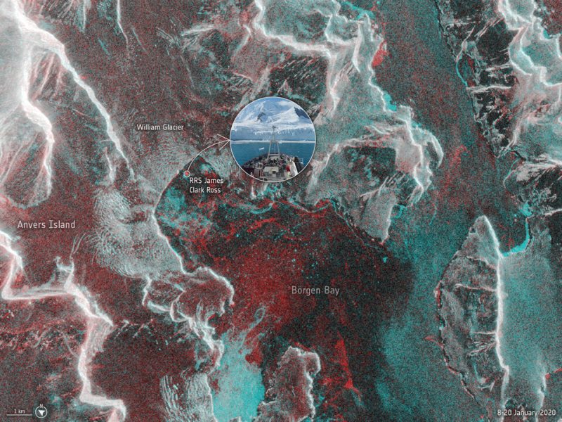
Remarkably, one of Europe’s Copernicus Sentinel-1 satellites passed overhead while the ship was close to the Peninsula and captured a radar image.
The image below combines two Sentinel-1 images: one from 8 January 2020 and one from 20 January 2020 when the ship was in the bay, appearing as a red dot. The image captures the William Glacier and Börgen Bay, but more importantly, the red colors depict where the sea and ice surfaces changed between the two dates, while white indicates no change.
The amount of red clearly indicates the dynamic nature of the region, and the crevices and fractures on the edge of the glacier front are clear to see.
Bottom line: Check out this dramatic video of glacier calving in Antarctica. And read about how scientists’ measurements revealed what was happening under the water.
Source: Internal tsunamigenesis and ocean mixing driven by glacier calving in Antarctica
The post Glacier calving in Antarctica: Video and science first appeared on EarthSky.